 Port Credit Marine Survey & Yacht Delivery |
12. Charts, Maps & Guides |
|
Maps are things that few cruisers will think
of until they are well underway on
this trip
however they are an invaluable source
of
information not available on charts.
Maps
help provide an overview of where you
are,
what may be just off the strip charts
and
longer distances more easily calculated
than
flipping pages of a chart book. Skipper Bob’s” guides are indispensable but NOT infallible. These are the only ICW guides worth buying as they provide a tremendous amount of information with on-line updates. Most other guides to the east coast seem to be
little more than glossy ad’s for over
priced
marinas. |
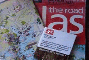 Collection of maps and Tourist brochures. 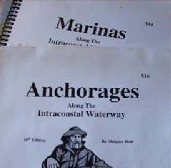 Skipper Bob's Guides 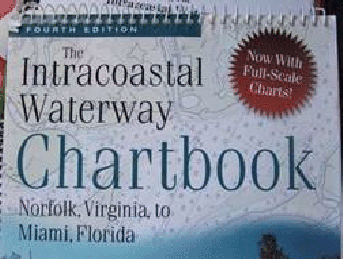 Easy to follow strip chart book 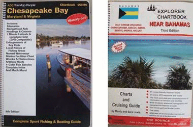 ADC Chesapeake - Explorer Bahamas chartbooks ADC Chesapeake - Explorer Bahamas chartbooks |
| The Intracoastal Waterway Chartbook sells for about $90.00 in Toronto but we
got ours for $7.00 (new & current)
on
E-bay. This is the ICW "proper"
chartbook that we use as it’s in strip
chart
form and its handy 9” X 11” size makes
it
convenient to use. The print quality
is reasonably
good and this is important after 10hrs
of
staring into glare. It does of course,
like
all other charts have its deficiencies.
The
strip format cuts off many areas outside
of the waterway proper including parts
of
some inlets (photo below) and many of the pages do not show lat/long
or a compass rose where I consider
them a
necessity. |
|
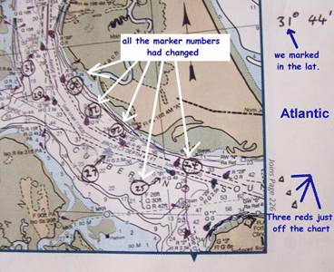 The photo above shows a page from the “Intracoastal Waterway Chartbook” where mark numbers have been changed, there is no compass rose and lat/longs are missing. Most of this can be fixed by marking in the lat/longs yourself, as I have. Despite its short falls I think it’s the way to go. We just take the time to mark in the lat/long lines and rose. |
|
| We stumbled across the incomparable “ADC” chartbook for the Chesapeake in a book store which,
like the ”Explorer” chartbooks for
the Bahamas
are high quality printing on very good
quality
paper with a tremendous amount of useful
information thrown in. I have never
seen
any better chartbooks than these. The Bahamas “Explorer Chartbooks” charts have almost every necessary waypoint painstakingly corrected by real cruisers to real GPS positions (not so with some others) and are unquestionably the best Bahamas charts available . Paper quality begats print quality and if you are staring at these things 6-10 hrs/day crisp clean print becomes an important issue. Why can’t the big chart printers like Richardson, BBA or Maptech print good quality charts like ADC or Explorer |
|
You can buy a New York State canal chartbook through the usual marine sources or you can get an excellent cruising guide / chartbook for half the price from the New York State Canal Corporation . Other great resources .......... The Salty Southeast Cruisers Nets. This site is constantly updated with all the changes on the ICW from bridge closures to shoaling report. You must visit on a regular basis. The Active Captain. On this site you can view all the ICW charts, satellite photos and then overlay them for a frontseat view of the entire ICW at your computer. Oh yeah … don’t forget the eye drops as hour after hour of squinting at charts or staring into the glare can be really hard on tired old eyes. |
|